


Popular
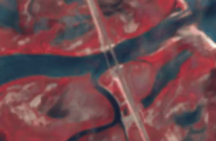
Russian military forces on June 14 set up a pontoon crossing near a damaged bridge close to the city of Henichesk, not far from occupied Crimea.
The user you1126 published a Copernicus satellite image on their X account.
This crossing leads to the Arabat Spit and is part of Russia’s land-based logistics in the south.
The Russians also built a pontoon bridge in the Chonhar area after the fixed crossing was damaged as a result of a Ukrainian strike.
According to satellite monitoring data, the pontoon crossing appeared on June 7.
あ、ポンツーン橋みっけ(2つ目)。爆破されて、どうぞ。ヘニチェスクのすぐ南の道路橋の脇。46.14776,34.80705地点。 pic.twitter.com/ueeyrZGtKi
— you1126 (@Rb3qzWR5AK5nooA) June 14, 2026
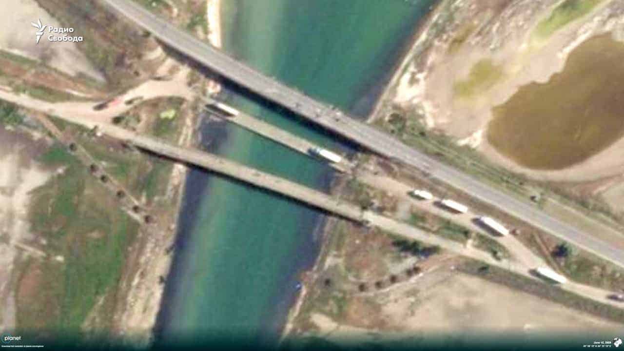
Later, it was recorded that queues of Russian trucks had formed at the approaches to the pontoon crossing near Chonhar, as they traveled from occupied Crimea to the temporarily occupied part of the Kherson region.
In an image taken on the morning of June 12, at least 17 trucks and several passenger vehicles were observed before the crossing in the direction of Kherson region.
About 15 trucks were waiting to pass at the Dzhankoi checkpoint.
Meanwhile, no passenger cars or trucks heading toward Crimea were visible in the satellite image, although there is still a shortage of fuel and some everyday consumer goods on the peninsula.
Later, Ukrainian forces carried out another series of strikes, including on this pontoon crossing.
On the night of June 15, the Ukrainian Defense Forces again attacked bridges leading to the occupied Crimean peninsula.
During the night attack, the bridge near Chonhar was damaged. The bridge connecting Henichesk with the Arabat Spit was also damaged.
Підтримати нас можна через:
Приват: 5169 3351 0164 7408 PayPal - [email protected] Стати нашим патроном за лінком ⬇
Subscribe to our newsletter
or on ours Telegram
Thank you!!
You are subscribed to our newsletter