


Popular
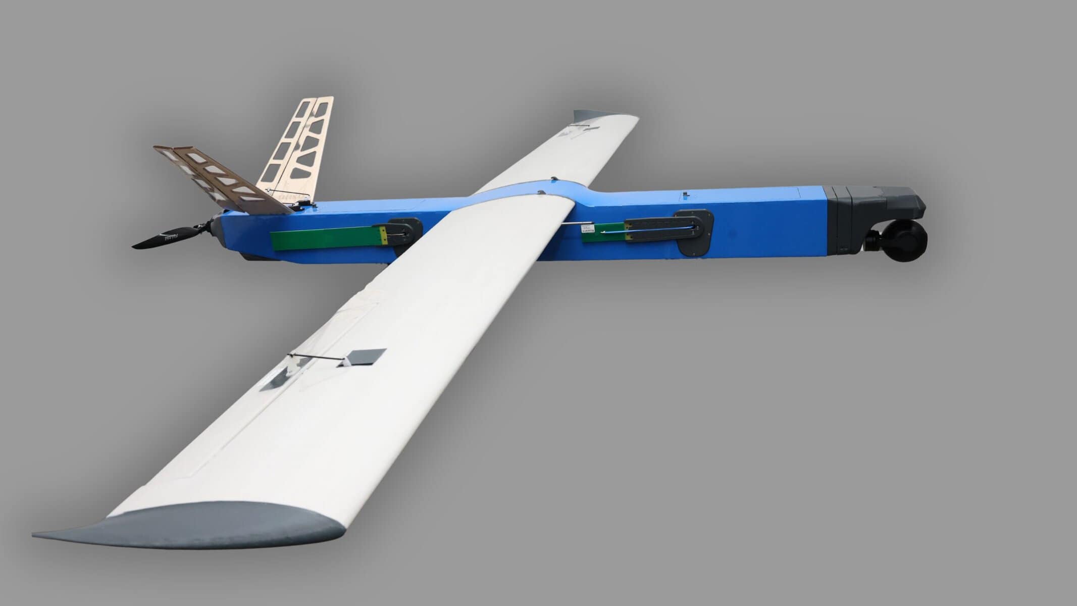
The Ukrainian company Besomar develops drones with support from the Brave1 grant program and the European Cluster for Drone Innovation (ECDI).
The company Besomar reported this to Militarnyi.
The military line is represented by the Besomar 1100 reconnaissance unmanned aerial vehicle.
Structurally, the UAV is built according to a classic aircraft configuration with a straight, high-mounted wing and a V-shaped tail. Winglets are mounted at the wing tips. A propeller is located in the tail section, and an optoelectronic surveillance system mounted in a gyro-stabilized gimbal is installed beneath the nose of the fuselage.
The UAV is designed for aerial reconnaissance and long-endurance surveillance. The system is already being delivered to Ukrainian units for combat use.

The Besomar 1100 has a range of up to 100 km and a flight duration of up to 4 hours. The UAV has a cruising speed of 90–100 km/h, a maximum speed of up to 160 km/h, and is capable of operating at altitudes of up to 5,500 meters. Special technical solutions have been implemented in the system to counter electronic warfare (EW) measures.
At the same time, the company is expanding into the civilian sector by developing the Besomar 3210 FV system for aerial photography, mapping, and creating digital terrain models.
The project is being implemented jointly with Farsight Vision as part of the ECDI Civil Drones Innovative Programme. The joint development is intended for monitoring civilian and critical infrastructure, as well as spatial analysis.
In August, during field tests in Ukraine, specialists tested the full cycle — from executing the flight mission and collecting aerial imagery to its subsequent software processing.
During the test photography mission, the drone covered approximately 2.9 km² of territory, and the resulting aerial images were used to create an orthophoto map.

The Besomar 3210 FV has a takeoff weight of 9.7 kg with a payload capacity of up to 1 kg. The drone is capable of covering a route of up to 200 km with a range of up to 60 km and remaining airborne for over 3 hours. The civilian model’s cruising speed is 80–90 km/h, and its maximum speed reaches 160 km/h. Launch is performed via a catapult, and landing is carried out automatically.
The drone is integrated into the unified Besomar ecosystem, operates with its own ground control station, and is capable of navigating using beacons without relying on GPS systems.
Підтримати нас можна через:
Приват: 5169 3351 0164 7408 PayPal - [email protected] Стати нашим патроном за лінком ⬇
Subscribe to our newsletter
or on ours Telegram
Thank you!!
You are subscribed to our newsletter