




Popular

Spanish company INTEGRASYS has unveiled EO Master – a platform for object recognition in geospatial intelligence (GEOINT).
The tool applies artificial intelligence and machine learning to optical and synthetic aperture radar (SAR) satellite imagery, the company told Militarnyi.
The system’s main advantage is the full automation of routine intelligence tasks, eliminating the need for operators to manually review imagery.
Instead of analysts manually searching for military equipment at airfields or positions, EO Master does it automatically.
The platform compares detected objects against an extensive library of 3D models, including those of the latest military equipment. This allows the system to quickly and accurately distinguish actual combat vehicles, ships and aircraft from mock-ups and false targets.
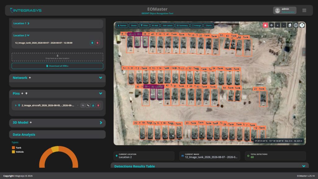
Specialists can set recognition confidence thresholds for each object class. The system allows users to identify targets down to the specific aircraft type and its position on the parking lot, while simultaneously monitoring multiple locations and imagery dates through user-friendly dashboards.
The results of automated processing can be exported as KML files or compiled into proprietary Earth Observation Report reports. This provides defence and intelligence agencies with a verified documentary record of observation data with precise timestamps.
EO Master was first launched more than two and a half years ago, in March 2024, at the SATELLITE exhibition in Washington, D.C.
Since its launch, the developers have continuously expanded the platform’s capabilities, adding military equipment recognition across the air, maritime and ground domains.
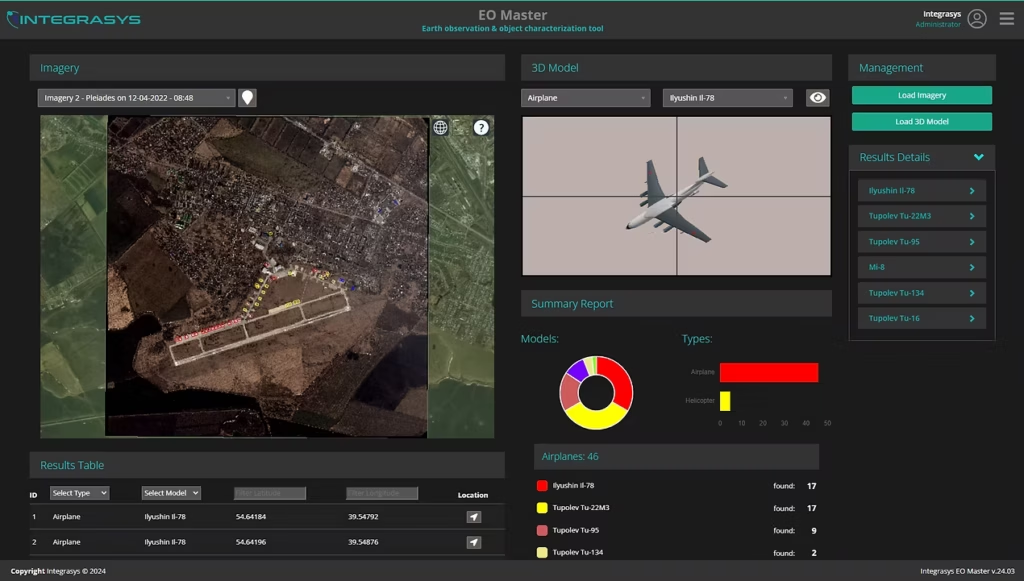
The tool is already integrated into the operations of defence ministries and intelligence agencies in several NATO countries.
“In addition, EO Master is already integrated into a unified interface with two other INTEGRASYS modules: INTEGEO, which combines signal geolocation data, and AIS, which is used for vessel tracking,” the company emphasised.
Military personnel consider the platform important because it allows data to be transmitted to frontline troops’ tablets while using minimal bandwidth. This significantly shortens the kill chain.
Підтримати нас можна через:
Приват: 5169 3351 0164 7408 PayPal - [email protected] Стати нашим патроном за лінком ⬇
Subscribe to our newsletter
or on ours Telegram
Thank you!!
You are subscribed to our newsletter