




Popular
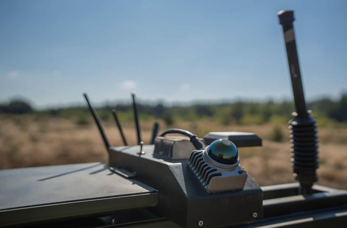
The Ukrainian-Estonian defense company Farsight Vision has unveiled a new navigation module for unmanned ground vehicles (UGVs) that helps them navigate the terrain in the absence of a GPS signal.
Company representatives discussed the development with Militarnyi.
The solution combines a laser sensor with 3D data from the FSV Platform. While in motion, the system generates a point cloud around the UGV, identifies obstacles, pits, slopes, and other terrain features, and helps refine the vehicle’s position.
The system is based on the concept of a digital twin of the terrain. A 3D model of the area is created in advance on the FSV Platform, against which data from the UGV’s sensors is subsequently cross-referenced.
While in motion, the laser module scans the space around the vehicle and updates the model with current data. Thanks to this, the operator sees not only a static satellite map but also the actual condition of the route in real time.
“Our goal is to eliminate the need to launch a reconnaissance drone just to escort the UGV, as this creates unnecessary risk and wastes resources,” Victoria Yaremchuk, CEO of Farsight Vision, noted.
The module’s key function is UGV localization. If the GPS signal is lost, the system can compare the sensor’s current data with a pre-built 3D model and help the operator restore the UGV’s spatial orientation.
The operator can control the UGV via a ground station, and after connecting to the FSV App, receives an additional 3D view of the route and the surrounding terrain.
By the end of the year, Farsight Vision plans to enable the UGV to autonomously return to the point where communication was lost or to a designated base several kilometers away, and subsequently scale this capability up to 30–40 km.

In May 2025, Farsight Vision presented technology for building 2D and 3D terrain models that can be used for route planning and operations in areas where satellite navigation is unavailable.
The new module continues Farsight Vision’s overall concept of creating an autonomous navigation ecosystem.
Militarnyi previously reported on the integration of the company’s software into the Mara and Besomar “photodrones” and a system for predicting signal loss zones for UAVs.
Підтримати нас можна через:
Приват: 5169 3351 0164 7408 PayPal - [email protected] Стати нашим патроном за лінком ⬇
Subscribe to our newsletter
or on ours Telegram
Thank you!!
You are subscribed to our newsletter