




Popular
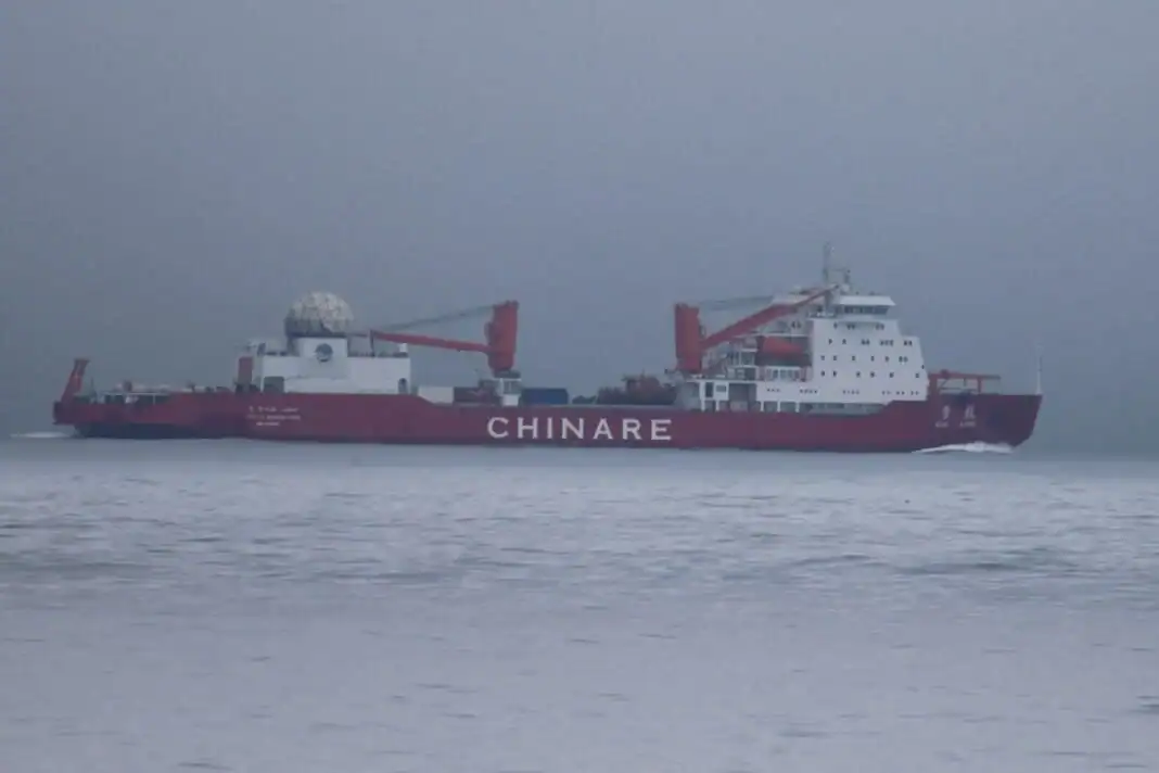
Two Chinese research vessels capable of reconnaissance entered the U.S. exclusive economic zone while heading toward the Arctic.
Defence Blog reported the incident.
It occurred near the coast of Alaska. The U.S. Coast Guard confirmed that it was tracking the Chinese research vessel Xue Long as it moved north through the U.S. exclusive economic zone and across the extended continental shelf in the Bering Sea.
It was accompanied by a second Chinese research vessel, the Xue Long 2.
In response, the Coast Guard sent the Legend-class cutter USCGC Munro to escort the vessels. In addition to the Coast Guard, the route of the Chinese ships was monitored by the U.S. State Department and the Pentagon.

Under international maritime law, foreign vessels have the right to transit through another state’s exclusive economic zone and extended continental shelf.
For this reason, the U.S. Coast Guard specifically emphasized that the passage of the Chinese vessels in itself does not violate international rules.
However, both ships are capable of conducting detailed seabed surveys and creating high-precision maps. Such data can be used not only for scientific research but also for military purposes, including planning submarine routes.
In addition, such platforms can be used to locate and map underwater infrastructure, including major Internet cables.
The passage indicates China’s growing efforts to expand its presence in the Arctic, primarily for military and strategic purposes. One manifestation of this policy was a joint Chinese-Russian patrol in the region in 2024.

China is conducting similar “research” operations in other parts of the world. In particular, on April 7, it was reported that an Indonesian fisherman had caught a Chinese reconnaissance underwater drone developed by CSIC (China Shipbuilding Industry Corporation).
The drone was presumably used to map the seabed and monitor shipping, with the collected information subsequently used for military purposes.
It was previously reported that China is implementing a large-scale program to map the seabed and collect oceanographic data in strategically important areas worldwide.
Chinese research vessels have been regularly recorded near Guam, Hawaii, and Taiwan, as well as in key areas of the Indian and Arctic oceans.
In particular, the Dong Fang Hong 3 repeatedly operated near major U.S. military bases in 2024-2025.
Officially, Beijing describes such expeditions as civilian missions, including mineral exploration, fishing, and climate research.

At the same time, naval experts note that information on seabed topography, water temperature, and salinity is critical for submarine navigation.
Such research also involves deploying hundreds of deep-sea sensors capable of detecting and classifying underwater objects.
In particular, in October 2024, a Chinese ship tested a sensor network near Japan, according to reports from the Ocean University of China.
Detailed seabed mapping allows submarine forces to maneuver more safely, better conceal their locations, and avoid dangerous areas. At the same time, understanding how sound waves propagate in specific areas significantly increases the effectiveness of searching for and detecting enemy submarines.
Read more on the confrontation between the U.S. and China in the Arctic in the article: “The Arctic as an Arena of Struggle Between the U.S. and China.”
Підтримати нас можна через:
Приват: 5169 3351 0164 7408 PayPal - [email protected] Стати нашим патроном за лінком ⬇
Subscribe to our newsletter
or on ours Telegram
Thank you!!
You are subscribed to our newsletter