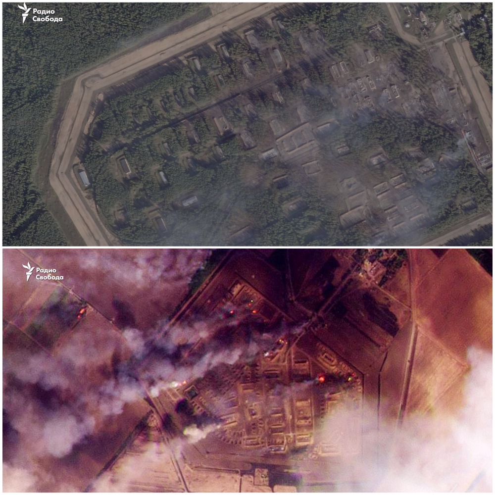
High-quality satellite images of Russian ammunition depots in the Krasnodar Krai and Tver region attacked by Ukrainian kamikaze drones have been published.
Radio Liberty released the pictures.
The publication compared satellite images of a warehouse near Tikhoretsk in the Krasnodar Krai, where, according to the United States, North Korean ammunition received by Russia from Pyongyang was stored.
The published photos show that some of the caponiers and buildings were destroyed as a result of the detonation of ammunition.
On Sunday, September 22, local authorities reported that operational and special services “continue to work at the depot’s site.” People are finding fragments of ammunition scattered during the explosions 10 kilometers from Tikhoretsk.
The attack on the warehouse near Tikhoretsk took place early in the morning, and, according to local authorities, the falling debris from the drones started a fire in the area where the explosive objects were located.
At the time, the governor of the Krasnodar Krai separately reported that the fire had spread to explosive devices, causing them to detonate.
It should be noted that two military units are located near the village: military unit 57229-41 and military unit 01704, used by the Russian Armed Forces for storage.

According to local reports, it was military unit 57229-41 that was attacked, resulting in a massive explosion. This depot attracted the attention of OSINT analysts, who were able to identify the active development of the facility and its use by the Russians to store North Korean shells.
The ammunition depot is located in close proximity to the village at coordinates 45.8870753059881, 40.04223668781141.
Radio Liberty also released pictures of the second Russian 23rd arsenal of the Main Missile and Artillery Directorate of the Russian Defense Ministry (GRAU) in the village of Oktyabrsky, Tver region, which the Ukrainian Armed Forces hit.
Most of the ammunition storage areas in the northern part of the arsenal were completely burned out, while the southern part was virtually untouched by the attack. Earlier, the 107th Arsenal in Toropets was attacked not far from this location.
The depot was attacked on the night of September 21. It is located 460 kilometers from Ukraine and has a smaller area of 2.6 square kilometers compared to the 107th Arsenal (5 square kilometers).
NASA satellites used to record forest fires also confirmed a severe fire at the arsenal at coordinates 56.359201802217775, 31.649876982142203.
Підтримати нас можна через:
Приват: 5169 3351 0164 7408 PayPal - [email protected] Стати нашим патроном за лінком ⬇
Subscribe to our newsletter
or on ours Telegram
Thank you!!
You are subscribed to our newsletter