


Popular
New satellite images have emerged showing the aftermath of a kamikaze drone attack on a Russian air base near the city of Morozovsk in the Rostov region.
These photos, released by OSINT analyst Brady Africk on X, are dated June 18, 2024.
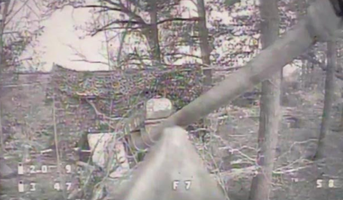
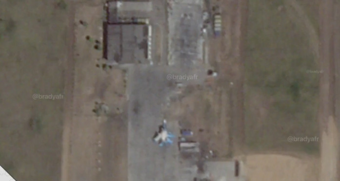
The images reveal that the Russians have dismantled the roof of a previously damaged hangar, which earlier images indicated contained two aircraft.
Although the resolution is low, a structure resembling the hangar’s frame is visible. This suggests that the Russians might be planning to rebuild it, or that the dismantling work was still in progress when the photo was taken.
Imagery from a few days after Ukraine’s drone attack on Morozovsk air base in Russia shows the remnants of the damaged maintenance hangar have been removed. pic.twitter.com/Z0CAdyhwDg
— Brady Africk (@bradyafr) June 21, 2024
Additionally, a plane is seen near the dismantled hangar, with part of it exhibiting a yellowish color. This could indicate that the coating was damaged during the attack or that part of the fuselage has been covered with cloth.
On the night of June 14, the Morozovsk air base and energy infrastructure were attacked by kamikaze drones.
The 559th Bomber Aviation Regiment of the 1st Guards Composite Aviation Division of the Russian Aerospace Forces is based at the airfield. Su-34 fighter-bombers, as well as Su-30 and Su-35 fighters, are based at the air base.
These aircraft are used by Russia to carry out air strikes against the positions of the Armed Forces of Ukraine and Ukrainian settlements near the frontline and bordering Russia.
According to the images of June 1, there was a cluster of planes near the hangar, and as of June 14, there was a large spot on the site.
It can be assumed that it was formed as a result of fuel leakage due to damage to the tanks.
OSIN analyst MT Anderson published an image dated June 13, which shows that an unknown number of aircraft were still parked.
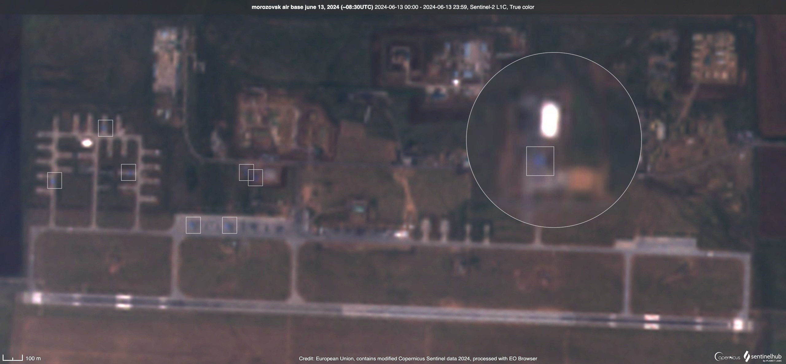
It’s likely that they were damaged or even destroyed in the attack, but the Russians quickly removed them.
At one of the parking lots, at approximate coordinates 48°18’51″N 41°47’20″E, a round spot is visible that was not on the June 1 images. This could likely be the site of the drone strike.
In addition to the air base, the drones attacked a local electrical substation, which was damaged.
Підтримати нас можна через:
Приват: 5169 3351 0164 7408 PayPal - [email protected] Стати нашим патроном за лінком ⬇
Subscribe to our newsletter
or on ours Telegram
Thank you!!
You are subscribed to our newsletter